Canada/Alaska Adventure | Entry #7

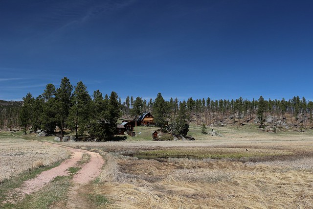
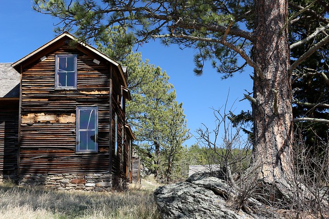
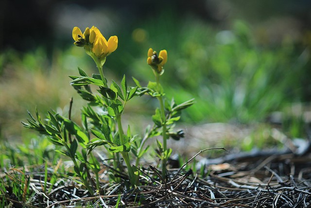
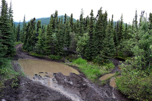
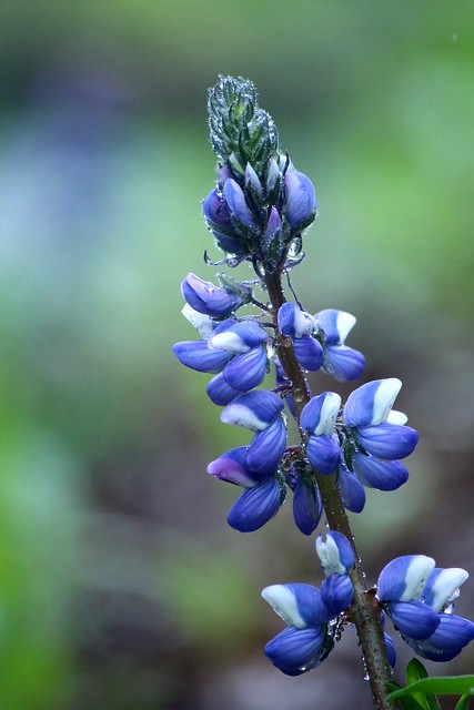
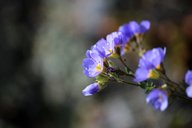
When Jenny and I headed out on the fourwheeler at 9pm last night, we had kind of expected a more leisurely spin. I’d never done any fourwheeling, so anything would have been fun for me! The trails we intended to ride on were reported to be in good condition and to have been recently repaired, to some extent. A fifteen minute drive got us to the old Glen Highway, and another ten minutes got us out into the real off-roading.IMG_9544The area was beautiful. The landscape, a boggy tangle of spongy moss and lichen and slender spruce, sprawled to the mountains, the tops of which were buried in clouds. The trail became more mountainous as we climbed towards the pass, crossing a few streams, taking alternate routes around the largest puddles, some of which were deceptively deep – we found out the hard way. On a number of occasions, we almost ended up stuck, which at a minimum would have been very embarrassing. A couple of the bad spots almost made us turn around, but then the road would get better so we’d keep on trucking! It was a gorgeous evening. Why turn around?

IMG_9546 We were never quite deterred until we got to a particularly steep spot requiring some tricky maneuvering. I hopped off to make the maneuvering easier for Jenny, and as I did, I got a whiff of that unmistakable smell of something big definitely dead. I mean, it wasn’t just a dead rabbit close by. “Jenny, do you smell that?” I asked uneasily, as the stench got stronger, at the time that she was processing the same thing. We both had the “Let’s turn around now” feeling, and did so as quickly as she could get the fourwheeler turned around on the muddy slope. We had a tense couple of minutes there on the slick, steep, rutted slope, with pretty thick brush and uneven terrain on either side of us, and poor visibility as a result. The turn around was challenging enough, but if we’d gone on any further, Jenny said we wouldn’t have been able to turn around until we reached the top of the trail. With a persistent creepy feeling, we headed back down the trail. That stench sticks with you, particularly when there’s a good chance the stench was from a grizzly cache. We would have felt at least a little better if we had brought a bigger gun.

I wasn’t quite able to shake the creepy feeling until we got back home at 11pm and warmed up with some hot tea. Nothing like that to get your heart pumping!

Save

Save

Canada/Alaska Adventure | Entry #4

“Hey, Aunt Sandy – what do I do if I see a moose?” I was getting ready to take the mail down the road past the sawmill to the mailbox in a light drizzle. “Give it its space,” she said. “And get behind a tree?” I asked. These are important questions when you come from a region without moose.
IMG_9051I headed out, raincoat-clad, camera in hand, into the cool moist of a rainy Alaskan day. Muddy road, dripping trees, everything drenched – perfection. I got down to the sawmill, and on the far side was the road and the mailboxes. Beyond the mailboxes I saw a large shape go running by. A moose. I stopped, waiting to see what the critter would do, and sure enough he crossed the road into the sawmill yard. He saw me, and looked at me as he browsed from the trees. I stayed over in the sawmill for a few minutes, watching him to see where he’d go, and finally I took a roundabout way to the road to get to the mailboxes. He was still there when I came back. For probably anyone who lives in this area, the encounter would have been nothing – but it was a pleasant adrenaline rush for me! IMG_9061eOn my way back to the house, I was thrilled to find a ladyslipper orchid, which I’ve never seen other than in books. The rain makes everything look so alive and rich. Bluebells were spangled with raindrops, some of them open and wide awake, others still taking their time to bloom. IMG_9097eIMG_9086eIt has rained all day today, and it rained more or less all day yesterday as well. Heavy clouds sit over the mountains around us, enveloping us, but every once in awhile, the fog and clouds will lift, enough that we can see the fresh snow on Victory Peak above us, or the etched slopes of Amulet Peak across the valley, though we can’t quite see the top of Amulet because of the cloud cover.

It is nice to have a few quiet days after the craziness of last week. But tomorrow the rain is supposed to let up, and the gardening will begin! Looking forward to a little sunshine!

Save

Canada/Alaska Adventure | Entry #3

Okay, now I have a little time to go back and catch up on last week! After my first entry, we got busy in Whitehorse and there really wasn’t any good time for posting! Then when I first got to Alaska last Thursday and did have time for posting, I was frankly too tired.IMG_8063eIMG_8551eJust a summary of the events of last week: Monday through Wednesday, we shot the pilot episode of what is planned to be a web series. We filmed at three different locations – Maria’s cabin off Lake Laberge, a German bakery in Whitehorse, and a wooded trail behind a neighborhood overlooking a lake, also in Whitehorse. And yes, it was fun wandering around dressed up in Anne of Green Gables era clothing. A lot of fun. IMG_8498IMG_8523When we weren’t filming, we enjoyed Maria’s company in the evenings, lovely conversations over dinner and late into the evening, took walks along the shore of Jackfish Bay, and were also introduced to various sights and scenes of Whitehorse and the Yukon by the director, Bogna, and her husband. They took us on a “driving tour” on Wednesday evening, to a few scenic spots for pictures and walking. I couldn’t get enough of the lupines, or of the Jacob’s ladder!
IMG_8595eIMG_8332eIMG_8201eDelana had specifically requested that we stop by a Whitehorse sign for pictures, which we did, of course. Of all the pictures on the Whitehorse “welcome sign,” the one I zeroed in on was the bulldogger. And in case you were curious, there happens to be a Yukon rodeo association. We drove past it on the way to Maria’s cabin.
IMG_8651IMG_8295eThe Yukon was a brand-new adventure, and it is a place I hope to see again! Very different from the other places I have seen, with its own temperament and mood, and it was beautiful. So beautiful.

Save

Save

Canada/Alaska Adventure | Entry #2

Settled in with my aunt and uncle near Sutton, Alaska – We got in after 2am, and I managed to catch up on my sleep this morning, at least a little bit. It has been 12 years since my first (and only) trip to Alaska, and it is wonderful to be back. This picture is from my trip  back in 2005, and it would be the view out the livingroom window right now, if Amulet Peak wasn’t shrouded in cloud. The elevation of this mountain is 8200 feet, but it is obvious looking at it that the elevation gain from the foot of the mountain to the summit would be significant – most of that elevation. Compare this to Harney Peak in the Black Hills, the highest summit east of the Rockies, which is elevation 7200 feet, with a relative elevation gain of only about 2000 feet when climbing it, since the whole Black Hills sits at probably an average of 3000 feet above sea level (my number, not sure what the actual average would be). Below the mountain can be seen, just barely, the Matanuska River, upstream of which is the Matanuska Glacier. 
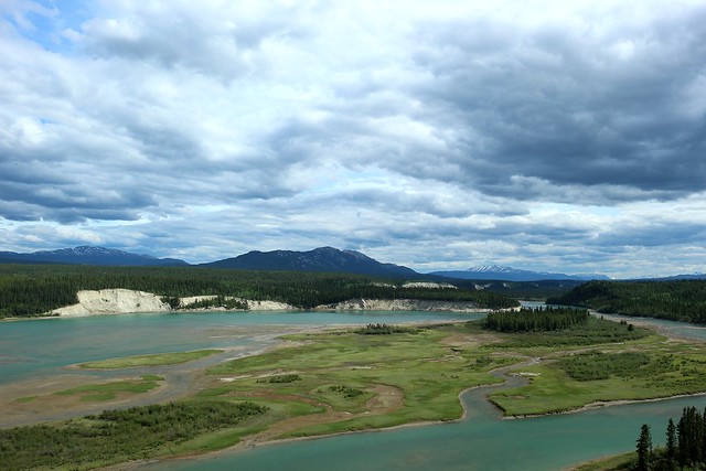
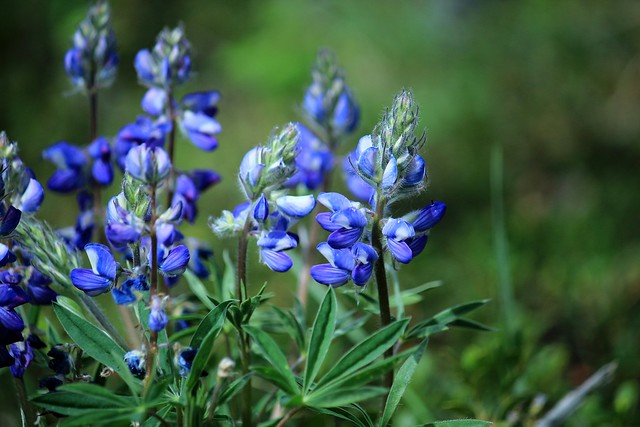
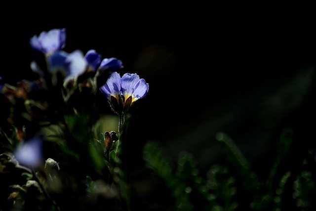
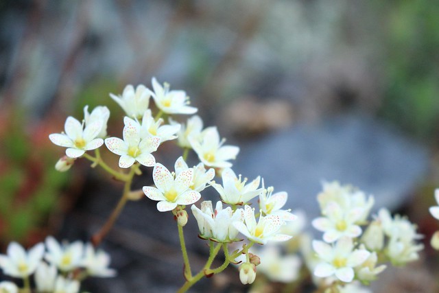
The snow-capped peaks, mountaintops buried in cloud, the massive, soaring mountainsides, sweeping valleys, gleaming rivers, and glorious vistas – this is an amazing part of the country. And I’ve got nearly a month to enjoy it.

Save

Save

Hiking | The Meeker Ranch

Once again we spent a Sunday afternoon haunting beautiful ruins in beautiful country. The Meeker Ranch is an historic site now owned by the Forest Service, east and north of Custer, SD. It dates back to the 1880s, and was built by Frank Cunningham Meeker, who, according to the Black Hills and Badlands website, was a member of the Pony Express, which ran for a couple of years along the Cheyenne-Deadwood Stage line. Frank Meeker named his idyllic 278-acre spread “Willow Creek.” The ranch passed through several ownerships over the years, finally coming into Forest Service possession in 2004. They undertook restoration and preservation of the ranch when acclaimed watercolor artist Jon Crane helped lobby against the slated demolition of the structures. This breathtaking historic site has been the target of some vandalism in the past, but overall is beautifully preserved.IMG_6640e Inside the main ranch house, there are still shreds of curtains, canisters of coffee (these people were obviously coffee-drinkers!), hangers in the closet, old newspapers and magazines, and wallpaper on the walls.  Glass sparkles in shards on the floor, whole jars littered among the wreckage. It must have been a lovely, fashionable home in its prime, and now just wisps of the memories cling here and there around the walls.IMG_6655eIMG_6844eIMG_6696eIMG_6733eIMG_6685eIMG_6693eIMG_6721eIMG_6740eIMG_6759eAround the homestead, perched on the hillside in among massive boulders and rock outcroppings, other structures cling tenaciously. The barn fittingly presides over the other structures, towering above them in wonderful condition, while the others have fallen into some level of decay. Buildings out here, scattered through the Hills, are so old and rugged that they seem to have sprung from the ground, rather than to have been built upon it. They belong where they are.
IMG_6794eIMG_6781eIMG_6855eFrogs were singing in the little marsh below the house, singing and trilling so loudly it was almost uncomfortable – What a beautiful summery sound! The scent of pine resin was heavy in places, another sign of summer-to-come. Every time I get a breath of resin in the warm sunlight, a wave of nostalgia breaks over my soul, wrapped up in the beautiful memories I’ve treasured since childhood, of this place I now get to call home. Wildflowers were blooming along the short trail, little goldenpeas and pussy toes and even a few long spur violets. Springtime is truly here! IMG_6873eTo get there, head north out of Custer on Sylvan Lake Road. Take a right on Willow Creek Road. After a couple of miles, the road will become considerably rougher and narrower, so don’t take a vehicle with low clearance. After about a half a mile on this stretch, there is a Forest Service gate and some parking space. The Forest Service access road continues beyond the gate, and is about a half mile hike to the ranch.

A stunning piece of history.


Hiking | Poet’s Table

I always love a new hike. Yesterday, I hiked to a hidden gem of the Black Hills – The Poet’s Table. And since it is an unmarked trail, it is pretty easy to keep it somewhat secret. I went with people who had been there before, which really is the best way to go in the case of the hike like this one, since it would be pretty hard to find it without a guide, even with directions.  The hike is a good scramble in places, not an easy hike, in spite of the short distance. From the trailhead to the Table only takes about 20 minutes, but it involves climbing a crevasse or two and some steep inclines.IMG_5723eWe started at Little Devil’s Tower Trailhead, which would be the most direct route. Since Little Devil’s Tower Trail is part of the Harney Peak Trail System, and the Poet’s Table trail is a spur or loop off the main trail, one could easily incorporate Poet’s Table into a longer hike. If you decide to do this, do Poet’s Table at the beginning when you’re fresh. Not at the end when you’re already tired and footsore.
IMG_5689eIt really is a delightful location, well-hidden, sheltered, and quiet. People who argue that the Black Hills aren’t mountains haven’t seen places like this. Soaring rock spires conceal this spot, and mountains fall away in the distance. A table and chairs and a cabinet filled with notebooks furnish the nook. People have signed their names on the walls, painted pictures, written poetry in the notebooks, and someone even left a bottle of Jack Daniels. There were remnants of an old campfire, and other odds and ends of trinkets and oddities left by previous passers-by. IMG_5672e We meant to eat a camping lunch up there, since I had missed out on the camping trip due to being sick, but a thunder storm rolled through just south of us, barely touching where we were. We could hear the thunder, so we debated for roughly twenty minutes about whether or not it was foolhardy to be sitting up on rocky cliffs with a thunder storm going on (the answer being “yes”, of course), until the storm basically blew by. By then, we weren’t really hungry and dinner was getting close anyway. IMG_5697ePack a picnic lunch. And enjoy the hike and the accompanying pristine views. The Black Hills at their best.