Greeting 2020

We (Mom, Sarah, and I) welcomed the new year and the new decade from Harney Peak, the highest point east of the Rockies! It was a beautiful, crisp morning, the stars were glorious at 6am, the snow crunched pleasantly underfoot, and the wind was gentle enough for us to actually de-layer shortly into the hike.

Harney Peak on New Year's Day

There wasn’t even a hint of dawn when we started up, and we trudged along in the dark, our headlamps casting pleasant shadows in the snowy woods. There were a few other cars at the trailhead, and evidence along the way of other first-day hikers, including this snowy tribute to the new year:

Harney Peak on New Year's Day

And then the first day of the year dawned: gloriously, slowly, from diamond-studded black, to silver and blue skies, then lavender, then pink and orange and scarlet, with the tips of granite spires just kissed with the first light. We reached the tower in the glow of the first sunrise, and watched the light spread over the Hills.

Harney Peak on New Year's Day

Harney Peak on New Year's Day

Harney Peak on New Year's Day

Harney Peak on New Year's Day

Harney Peak on New Year's Day

The wind was fierce at the Tower (it always is), and with a bitter edge, so we took shelter in the basement, warming ourselves with hot, black coffee and a snack before heading back into the wind.

Harney Peak on New Year's Day

The hike down was even more beautiful than the hike up, now that we could see the sculpted snowdrifts, the sun sparkling through the trees, and the sky and its blueness overhead.Harney Peak on New Year's Day

Harney Peak on New Year's Day

Harney Peak on New Year's Day

What a wonderful way to bring in this new year and new decade, with two of my favorite people, doing one of my favorite things, on one of my favorite trails, in my (current) favorite place in the world, on the tip top of our highest peak, reveling in and wandering around and gazing at God’s beautiful handiwork.

I love experiencing the firsts of the new year.

The first morning.
The first drive.
The first hike.
The first time up Harney Peak.
The first picture taken.
The first cup of coffee.
The first sweet family time.
The first prayer.

The new year comes, fresh, unstained, and (from our perspective) unwritten. We do a pretty good job of staining it as soon as we open our eyes or our mouth on New Year’s morning, but the freshness and excitement and sense of newness remain, the gladness of a fresh start. There are things I’m anticipating, things I’m excited about, things I’m not looking forward to. But I’m glad to know I serve a sovereign LORD who isn’t just writing my story, as if He is still in the process of figuring it out. He has written it, already.

Harney Peak on New Year's Day

I wonder what He will choose to bring to this new year? I wonder what growing, what joy, what delight, what blessings and struggles and trials and pain? What adventures? What changes are coming that I haven’t even thought of yet? What triumphs? What failures? What of Christ will I see or learn that I haven’t yet known? How will He refine me?

2020 is open like a brand new book. I’m excited to read the story.

Happy New Year!

Hiking | Grand Canyon Rim-to-Rim, Part 2

Fourteen miles down. Ten to go. And there was Phantom Ranch! IMG_20191007_100550957_HDRWe arrived gratefully at Phantom Ranch around 10am (we made really good time!), and took a lovely lunch break. We took time to change socks, rehydrate, and mail postcards from the canteen, which were stamped with the words “Delivered by Mule.” We visited with other hikers and runners, and finally got back on the trail, right into the heat.

The sun was high by now. And we three poor northern girls were definitely missing the cool of the morning. But we slathered on sunscreen, sported our brimmed hats and chugged plenty of water and electrolytes. We were good to go. The distance between Phantom Ranch and River Resthouse passed quickly, and we enjoyed the long views up and down the Colorado as we crossed the long span of the Silver Bridge, and a bighorn sheep posing beautifully for us next to the trail.IMG_20191007_112008605IMG_20191007_112233274_HDR
IMG_20191007_112244913_HDRIt was after the River Resthouse that the hiking started to get harder. We felt the miles behind us, and still had nine to go. And now the elevation gain started. When you’ve already hiked 14 miles, and now the elevation starts, oh, you feel it. You feel it.
IMG_20191007_123425736_HDRFirst comes The Corkscrew:
IMG_20191007_123407928_HDR
IMG_20191007_124254856_HDRThe Corkscrew is an intimidating series of bigger and bigger switchbacks, bringing you out of a small canyon up into a larger one. The switchbacks seemed endless, and now we were hiking in the sun and the heat. It took forever to reach Indian Garden Resthouse, and then we had four and a half miles to go, with 3-Mile Resthouse and 1 1/2 Mile Resthouse splitting up the rest of the distance.
IMG_20191007_125245552_BURST000_COVER_TOPIndian Garden was memorable. They were doing construction of some sort and had a crazy helicopter thing bringing in equipment and taking stuff out. When we finished and were looking down into the canyon, we could still see it, 3000 feet below. Amazing.
IMG_20191007_143221648_HDR
IMG_20191007_155319016_HDRThe last three miles were the toughest of all, and possibly the most beautiful. The sun was dipping lower and a shadow was spreading over the trail, so the heat was no longer as much of an issue. But by now, we had already hiked 21 miles. With the whole canyon spread out behind us, and with us slowly creeping our way up the precarious side of the canyon, the bigness of the canyon was overwhelming and awesome.
IMG_20191007_155319016_HDRWe could catch glimpses of the next resthouses, or glimpses of the Rim, and we could see trail and switchbacks that we were aiming towards way in the distance or way overhead, hundreds or thousands of feet up. If we looked hard, we could barely make out other hikers, looking as small as fleas. I’ve never felt so small in my life. At Indian Garden, there still is 3000 feet of vertical gain left. At 3-Mile, there is 2100 feet left. And at 1 1/2 Mile, there is 1100 feet left. We knew we were getting closer, but until you’re done, the hiking is just plain hard.
IMG_20191007_155429565_HDR
IMG_20191007_155445675
IMG_20191007_160238051_HDRFrom here on out, certain groups looked tireder and tireder, while others looked fresher and fresher (and less equipped, fit, or able. Flip-flops, for instance, 1500 feet below the rim). It was easy to pick out the day hikers from the Rim-to-Rim hikers. But Sarah and Jenny both commented on (and we all laughed at) the pitying, “judge-y” looks we received from clean, fresh-looking hikers who clearly were wondering how we could be so tired and worn-out looking so close to the South Rim.

And then we could see the end of the trail, and those last few hundred yards felt everlasting. We emerged at Bright Angel Trailhead shortly after 5pm, for a Rim-to-Rim time of just under 13 hours.
IMG_20191007_170535966_HDRIt was awesome. And terrifying. And exhilarating. And beautiful in ways I never expected.
Resized_2019-10-07_05.04.36_1IMG_20191007_172626628_HDRAnd I would do it again in a heartbeat.

Hiking | Grand Canyon Rim-to-Rim, Part 1

Finally!! This post series has been much anticipated and at last is ready to publish! Easily the highlight adventure of this whole year was training for and hiking a one-day Rim-to-Rim at the Grand Canyon in early October, with roughly 2 months of training hikes leading up to our trek. As a hike that makes it into the Backpacker Magazine list of top ten most dangerous hikes due to the heat in the summer, this is one I highly anticipated, and is the first hike of this caliber I’d ever done. What an adventure!

The Rim-to-Rim is a 24 mile hike boasting roughly 5000 feet of elevation gain (as well as 6000 feet of descent), exposed trail, amazing views, and the exuberance at the end of finishing such a monumental hike. The recommended time to take for this hike is 2-3 days according to the official literature, and the beginning of the Bright Angel Trail (the end of the trail for us) sports this lovely, inviting sign of a poor sunburned guy vomiting:IMG_20191007_170339998_HDR

There were lots of reasons for us choosing to do it in one day, but probably the biggest reason was the challenge. Just the challenge. It didn’t disappoint.

We got started in the wee hours of the morning on Monday, October 7. We had slept (sort of) for three hours or so in our car on the North Rim at the North Kaibab trailhead. We were all so excited, I’m not sure how much we actually slept. Then in the cold and dark, we got ready, bundling up against the winterish 27 degrees, excitedly greeted another group of early morning hikers in hushed tones, and with the adrenaline waking us up fast, set the first foot on the North Kaibab trailhead.

It was pitch dark at 4:20am, and the beams from our headlamps illuminated a sandy trail and heavy brush and trees on either side. The walking quickly became rather hypnotic. Walking in the dark is a strange feeling, without the changing scenery of the daytime, either for interest or perspective. We couldn’t see depth or distance, or the steepness of the terrain, or the switchbacks below us. We didn’t get far in before we realized we were not alone on the trail, and could see headlamps bobbing behind us and before us. What a strange sight, stories and stories below, headlamps bobbing along in the dark.

The trail wound along the canyon walls in series of switchbacks, until we could look back up and see again a trail of headlamps. How pleasant, and how strange. For an hour and more, that was all the perspective we got of the bigness of the canyon, the distance and closeness, both, of the headlamps in the dark.

Then the light. Our eyes were dazzled in the pale, dim light by the heights, and dropoffs, the winding trail clinging precariously to the sheer canyon sides, the color, and the signs of beautiful desert life. Prickly pear, huge and with large purple fruits, other strange cactus plants with towering spires 15 feet tall, plants that looked like yucca or mangave relatives. All beautiful and strange.

IMG_20191007_064546300_HDR

IMG_20191007_071528431_HDR

One of the best parts of this hike was the trail camaraderie, which began early on. One hiker in particular is a special memory, as we leapfrogged with him and his hiking partner for the first 14 miles. Mark encouraged and cheered us on, as a veteran Grand Canyon hiker, which was a huge boost to the morale of our little group.

IMG_20191007_065316922

Water stops were anticipated and appreciated, and hikers congregated in them for breaks and hydration and to use the pit toilets. There really is no place to go privately unless you use the pit toilets. The first stop was Manzanita Rest Area. Five miles was done. Nineteen miles left.

IMG_20191007_071534239

IMG_20191007_071747017_HDR

About 6 miles in, we had our first view of the South Rim, hazy and indistinct in the distance:IMG_20191007_074752664_HDR

It was exhilarating and rather terrifying and beautiful and awe-inspiring. It was so far away, so small in the distance, and so high up. That was where we were going. And at this point in the trail, we felt great. The trail was easy, temps were cool, we weren’t yet sore or tired, other than some knee pain I had anticipated and was managing with soft braces and Ace wraps on both knees (this was preventative, since I’d been having knee pain leading up to the hike), and a sturdy hinged knee brace for my right knee for the descent. I looked gimpy, but who cares?

I was surprised at how green and lush the canyon was. The trail follows a creek nearly the whole way, and the moist smell of water loving plants was unexpected. It was deliciously cool and fresh.

It was all a countdown to Phantom Ranch, which, though not the true halfway point, feels like a halfway point. But first, the Box.

IMG_20191007_085719296

IMG_20191007_085921048

IMG_20191007_090718442_HDR

We got to the infamous Box before the sun had even touched it, one of the most dangerous parts of the hike if you don’t get through it before the sun hits it. The narrow, steep sides of this four-mile stretch of canyon are dark stone which soaks up the heat, causing dangerous temperatures reaching well into the triple digits.

IMG_20191007_100319023_HDR

At last the Box was behind us and Phantom Ranch wasn’t far beyond. And it was starting to get warm!

Independence Day Adventures

Once again, I’m coming back to this blog after too long of a break! But summer has been busier than I anticipated, and sitting in front of a computer screen isn’t super high on my priority list when the weather is gorgeous and there are trails to chase.

However, yesterday’s adventures very specifically deserve an article, in the same vein as a few other of the “near miss report” or “hiking misadventure” articles I’ve written.

The glorious plan was to hike Harney Peak, the highest point east of the Rockies (and consequently the highest point in the Hills) and watch ALL the fireworks. All of them. Rapid City, Custer, I think Hot Springs, and any other private/freelance/illegal displays we’d happen to see. It really was a good plan. But as the afternoon wore on, the sky grew heavier with clouds, and as we drove up to Sylvan Lake and picnicked there with the rest of our friends who were to hike this with us, the rock spires were hazy and faint behind low-lying clouds. We knew there wouldn’t be anything to see from the top of Harney Peak. Except clouds. And I can see clouds anytime I want from the top of Harney Peak. And it doesn’t have to involve hiking up there late in the day, and getting back down in the wee hours of the night. But we figured we’d at least see the flashes from the fireworks, which some of the group actually seemed to think would be as good as seeing the fireworks themselves.
IMG_20190704_185417051_HDR
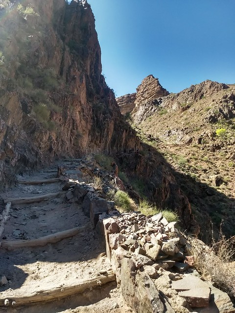
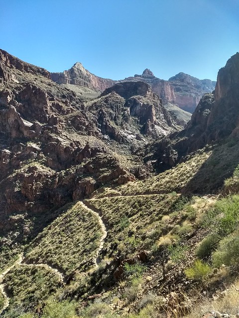
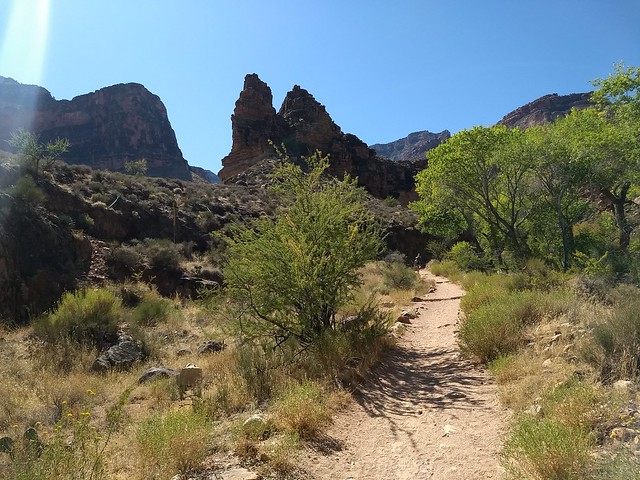
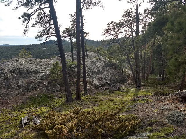
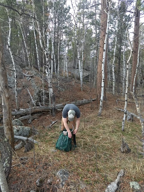
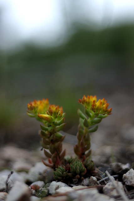
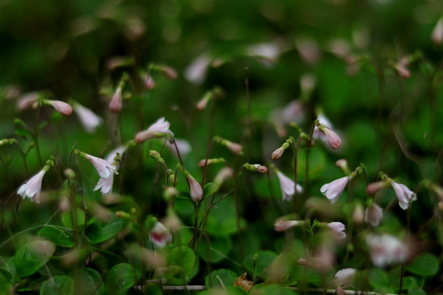
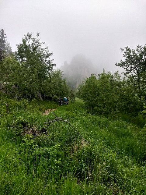
Anyway, we all wanted to hike, so we did. We were armed with rain jackets, plenty of water, some extra layers, cookies, summer sausage, and even a JetBoil and chai tea mix. We were set. None of us was really paying attention to the weather (oops), but as we hiked higher and higher, it grew foggier and foggier. It was a gorgeous hike, absolutely stunning. Trail #4 was more overgrown and green and lush than I’d ever seen it, with wildflowers galore, including spearleaf stonecrop, a little beauty I only discovered this year.
IMG_0189e
IMG_0192e
IMG_0199eWe made excellent time, and as we approached the spur to Little Devil’s Tower, we passed a group of three from St. Louis who had just come from Harney and were on their way down. Fog, fog, and more fog, was the report. Well, clever locals that we were, we continued our hike.IMG_20190704_191849647_HDR
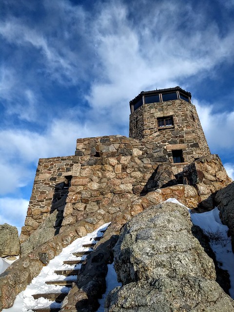
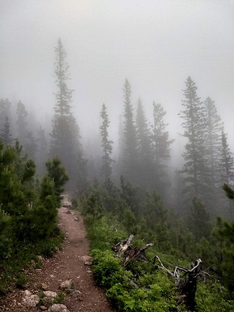
It rained on and off, so our rain jackets went on, then came off, and went on again, and when we were about a mile and a half or two miles from the top, the thunder started. It was faint and unthreatening, and although the recommended caution is to not hike if you can even hear thunder, I’m afraid no one around here would ever hike if we seriously listened to that advice, since it always thunders. Not saying people shouldn’t listen to that advice, obviously, but I’m simply reporting on reality…Anyway, we continued on to the top, and by the time we were out in the open approaching the peak, the lightening was happening pretty fast, and the storm was obviously getting closer, just about on top of us. There was some concern among a few of us, but the firetower was just ahead, just another five or ten minutes away, so we kept on. If we turned around, there was less chance of shelter, lots of snags and widow makers, lots of open ground, no place to hide. The fog was even thicker now, and the sun had set awhile ago.Sure enough, we arrived at the top in good order, and there was absolutely nothing to see. Nothing. One other small group was crazy enough to hike Harney to watch fireworks in the fog (also locals, predictably), arriving at the top just minutes after we did. The fog was thick, and the darkness grew thicker. The lightening was flashing all around, mostly sheet lightening, but the thunder was constant, so that the thunder couldn’t possibly be associated with any particular flash of lightening. A few in our group checked the weather radars, now that cell service was back, and we had a huge storm approaching, including tornado warnings for our area. Oh, joy. We texted family members and let them know we were safe, and would ride out the storm in the firetower. Rapid City had cancelled their fireworks and Custer apparently had shot all theirs off already, ahead of the storm. So much for seeing bursts of light through the clouds.

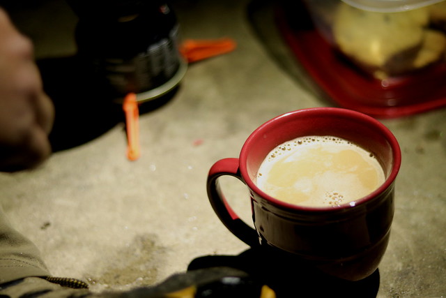
The storm hit with some impressive force. We had gone to the lower level of the firetower, which is grounded in case of lightening strike and is of solid cinder block construction, and were busy making chai, getting warm and dry, and eating cookies, when the wind kicked up and hail started pinging against the windows, which flickered and flashed ceaselessly with lightening. Lantern light cast comfortably creepy shadows.received_2140918526211436
IMG_0205e 
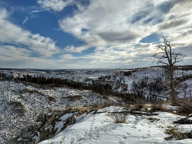
We sheltered in place for more than an hour, waiting for the storm to pass. When the main brunt of the storm was beyond us, a handful of our group went upstairs and their exclamations brought everyone up. The heavy fog and clouds had lifted, and we had wonderfully clear views…of everything. We could see the lights of Keystone, Hill City, Custer, Rapid, and more, and the storm played out the most amazing lightening show we could have imagined. It was glorious and terrible and beautiful. The black of night was studded with the gems of the lights of the towns, with just the outlines of hills visible. The darkness was shattered again and again as sheet lightening and bolts lit up the night brighter than day, blinding, dazzling, and for mere moments making the fleeing, scurrying clouds visible as they scuttled across the sky, and lighting up layers and layers of hills. Occasional fireworks were shot off in the distance, and the clouds broke in the west, revealing the most delicate crescent of a golden moon. What a beautiful night, waiting out a storm at the top of Harney Peak with good friends.IMG_0245e
IMG_0218e
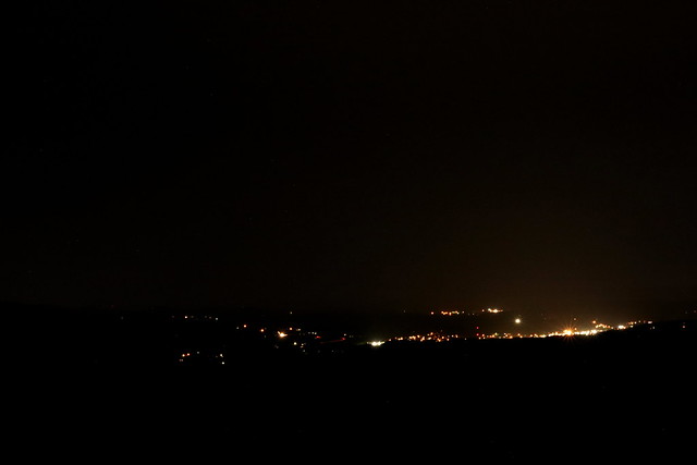
At last, there was a true break in the storm, and with another one set to hit in an hour and a half, we packed our bags and began the descent in the dark, our flashlights and headlamps bobbing along comfortably yet eerily in the blackness. It felt like we were the Fellowship of the Ring. Conversations bounced around quietly, there was occasional laughter, sweet friendship, and also a sense of calm urgency to make good time down the trail in case another storm hit. Lightening flickered way off in the lower sky, whenever we had glimpses of the lower sky, and thunder rumbled comfortably. The distance passed quickly in the dark.

It was midnight when we arrived back at the trailhead just as the rain was beginning to come in downpour. We hugged and said our goodbyes, and headed home, tired yet excited, and thankful that we were safe. The Christian radio station was playing the song “10,000 Reasons,” by Matt Redman. We sang along with it quietly, and the words were poignant.

Bless the Lord, oh my soul,
Oh my soul,
Worship His Holy name.
Sing like never before,
Oh my soul,
I’ll worship Your Holy name.
The sun comes up,
It’s a new day dawning;
It’s time to sing Your song again.
Whatever may pass,
And whatever lies before me,
Let me be singing
When the evening comes.
On Independence Day, it is so easy to get caught up in the patriotism and the celebration of freedom and hoping the best for our country. It is good to love one’s nation, and I love America. But the greatest freedom is the freedom that comes in knowing Christ, having our sins forgiven, our hearts changed, our relationship to God restored, and in living a spirit-filled life to please Him. What a way to celebrate the Fourth of July, with Christian brothers and sisters, wondering and marveling at the glory of His Creation, trusting Him for our safety (even in times of poor judgement), reveling in friendship and companionship, enjoying the freedom to worship our great God, and singing praise songs at midnight. And all this is just a foretaste of how glorious Heaven will be. America, I love you, and I pray that Americans would come to be known again as a nation that fears God. But America, you don’t hold a candle to the glory of Heaven, or even to the earthly glory of Christian fellowship, and I’m glad that I have citizenship there.
Soli Deo gloria.

Hiking | Buckhorn Mountain

Another gorgeous weekend and exhilarating hike in the books. I’ve really never found something I enjoy as much or as thoroughly as I enjoy hiking. We were going to hike Mount Baldy, but on the way home from church made a quick switch decision to hike something new instead. This may have been even better than Baldy…
IMG_20190407_164559265_HDRBuckhorn Mountain is a recognizable granite peak and ridge formation just north of Custer along Hwy. 16/385. What is generally photographed is not actually the highest point, however, so don’t let that throw you. Look at in on a topographical map and it makes sense, but I was confused for awhile when it seemed like we weren’t actually hiking Buckhorn.

There is no trail, so the best access is to hike up the Michelson Trail from town, and after about a mile head off trail east toward the peak. Keep it in view and you can’t get lost. As long as you can still climb higher, you’re not there yet. Round trip, it is a little under 4 miles. We picked what seemed like the most direct route(and the route that would include some boulder scrambling), up the west slope of the mountain, and boy, were we in for a treat! Plenty of scrambling to satisfy that craving, and gorgeous glimpses of views along the way up. We discovered a much easier route on the way down, however, on the south slope.

This peak clearly gets very little attention, and for good reason. There are a lot of snags and deadfall, steep slopes covered with duff, and lots of boulders. But if you feel like braving it, the view from the top is magnificent. The whole way up, we were watching a particular peak, only to get up to a saddle between it and the real peak and realize it was a false summit. This is a beautiful view of the false summit, from an open meadow on the way back down: IMG_20190407_164542021_HDRFrom the top, Crazy Horse, the Harney range, Custer, and everything in between is laid out like a map, clear and pristine and beautiful. I always enjoy getting up high enough that birds are soaring at eye level or lower.IMG_20190407_171725324

IMG_20190407_171209222_HDROn the way down, we found an easier route, which meandered through beautiful, open woods and boulder-strewn hillsides, emerald-green, kinnikinnick-covered slopes, and mossy spring areas. I can’t pinpoint the feeling exactly, but certain areas of the hills, including this hike, kept reminding me of Tolkien’s Middle Earth, or C.S. Lewis’s Narnia. Rugged, wild, and hauntingly beautiful.  Axel also found an intact deer rack, which he didn’t want but I did, so it got a ride back on his pack. IMG_20190407_172351841IMG_20190407_172620580Definitely a hike I recommend, if you like some rock scrambling and off-trail hiking!


Hiking | Hell Canyon Trail

Hell Canyon is one of my absolute favorite hikes in the Black Hills. In the spring and summer, the wildflower exhibition is dazzling, and I’ve found some unusual flowers on my hikes through the Canyon. But I’d never hiked it in the winter, which was a very different and beautiful experience. Hell CanyonA few trail stats: The trailhead is located about 10 miles west of Custer, near Jewel Cave National Monument. It is a well-marked, lightly traveled, approximately six-mile loop, which includes a short scenic spur along the rim of the canyon. It is generally recommended to hike the loop clockwise. I had the great idea to try it counterclockwise this time, and halfway through realized why it should be hiked clockwise. Hell CanyonWe had blue skies and warm winter weather for this hike, and worked up a lot of heat postholing it through the canyon. Our ice cleats were almost more of a hindrance than a help, since the snow was pretty heavy and wet and balled up in the spikes, making walking rather awkward at times. Overall, this is a pretty easy to moderate hike, except for where the trail climbs from the level of the canyon floor to the level of the canyon rim. Hence, why it should be hiked clockwise. Hell Canyon I once heard someone comment on the trail along the rim being dangerous, and was kind of puzzled since it seems one would have to try pretty hard to take any kind of serious tumble from the trail. My understanding for this person’s comment grew during this hike. When the trail is snowed over, the edge of the canyon can be difficult to see, and a number of times a miscalculated or clumsy step sent us awfully close to taking a steep tumble off the trail. I would now agree: in the winter, the canyon rim is rather treacherous. There aren’t really any sheer drop offs, but there are some steep slopes below the trail, and a tumble wouldn’t be a good thing at all. Hell CanyonWhat a day for one of my favorite hikes. Every time I’ve hiked it, new delights have stood out. I’m already getting excited for spring, and seeing it full of wildflowers again!